Groningen
€450.00
| /
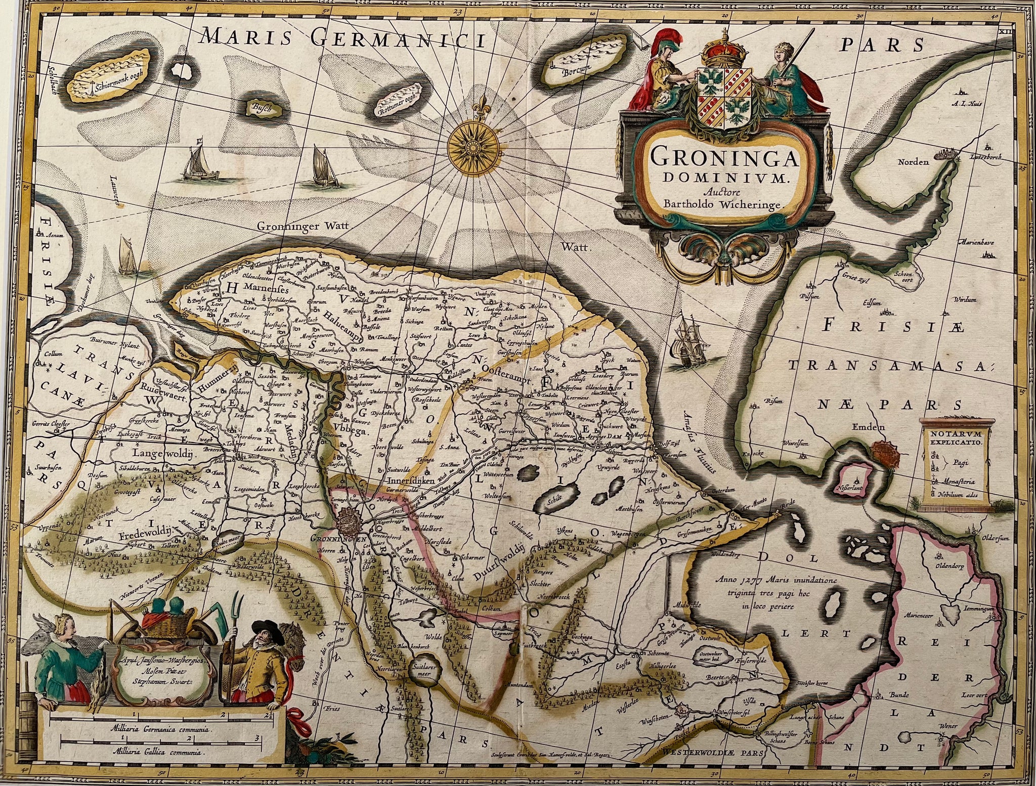
Title: ‘Groninga Dominium’ Auctore Bartholdo Wicheringe’ Contemporary handcoloured engraving published in ca. 1680
This map of the province of Groningen and the Ems estuary was originally drawn by Barthold Wicheringe. It shows Groningen, Netherlands on the left and Emden, Germany on the right. The map shows the Dollert (Dollart), a large basin in the estuary, with a note about the 1277 flooding of the villages when it formed. There is much detail shown on the map, including roads, dikes, fortified cities and pictorial topography. Two splendid cartouches enliven the map; the title cartouche is attended by a classical warrior and a depiction of Justice, and the scale of miles is surrounded by figures relating to agricultural. The plate was originally engraved by Jan Jansson. After his death it was inherited by his son-in-law, known as Jansson-Waesberg, who published it in conjunction with Moses Pitt and Stephan Swart.
Size: 38 x 49,5 cm
Condition: Very good (minor restoration at fold). Beautiful colours . Verso French text.
VAT: Margingoods
Search for: groningen, ommelanden, waddenzee, old map, antique map, schiermonnikoog, oude kaart, antieke kaar, emden,provincie, zuid laren,warfum, winsum borkum, rottumer oog, pieterburen